Thursday, April 17, 2008
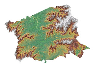
Lab Test - 04-17-08
Tonight's lab test was quite fun I thought.
ArcMap allows you to create maps very effectively and efficiently.
The Terrain Analysis exercise in Module 10 demonstrated the various surface analysis functions - all of which displayed their data in a very visual and easy to interpret format.
ArcMap allows you to create maps very effectively and efficiently.
The Terrain Analysis exercise in Module 10 demonstrated the various surface analysis functions - all of which displayed their data in a very visual and easy to interpret format.
Tuesday, April 15, 2008
Thursday, April 3, 2008
Class 04-03-08
Tonight's class was very interesting. I think the ability to insert buffers, and unions are an essential part of much environmental impact research, which is a field I am very interested in.
The capability of a GPS unit to track such detailed coordinates with such little effort is amazing - it was really cool to see where we had skiied and hopefully we can invest in a GPS so we cna track all of our adventures.
The capability of a GPS unit to track such detailed coordinates with such little effort is amazing - it was really cool to see where we had skiied and hopefully we can invest in a GPS so we cna track all of our adventures.
Thursday, March 13, 2008
Class 03-13-08
Class was very interesting, as it usually is. Worked on a lot of new things in exercises 10& 11.
The SIXTY minute video was a little long but I did pick up some time-saving tips!
The exercises really demonstrated how widely applicable GIS, espeicially exercise 10, from a business perspective.
The SIXTY minute video was a little long but I did pick up some time-saving tips!
The exercises really demonstrated how widely applicable GIS, espeicially exercise 10, from a business perspective.
Thursday, March 6, 2008
Class 03-06-08
Class tonight was very interesting - especially the Valladolid Expedition!
Exercises 8 & 9 were also interesting. I wish you could actually buy houses like that in CA for like $150k!
The abandoned Oil Pits exercise was alarming if those statistics are true - interesting too though.
Exercises 8 & 9 were also interesting. I wish you could actually buy houses like that in CA for like $150k!
The abandoned Oil Pits exercise was alarming if those statistics are true - interesting too though.
Tuesday, March 4, 2008
Class 03-04-08
Exercise 6 allowed me to learn a lot more as I was not just doing it step by step from the book.
I had to exercise a lot of trial and error, and I'd certainly rather be biking on the trails than tediously digitzing them!
It was pretty cool though how you could reference a set of data to the map by adding control points and then add the trails.
I had to exercise a lot of trial and error, and I'd certainly rather be biking on the trails than tediously digitzing them!
It was pretty cool though how you could reference a set of data to the map by adding control points and then add the trails.
Tuesday, February 19, 2008
Class - 02-19-08
I found the 'Creating Feature Class' and 'Editing Feature Classes and Attributes' chapters very interesting. I find these exercises quite intriguing as I spend a lot of time looking at Buncombe County's GIS and uses its various functions. Now I am aware of how changes are made within the system pertaining to lot lines, and subdivision and what not.
Thursday, February 14, 2008
Class 02-14-08
DRGs we looked at in class today were pretty cool, and it's nice that this area has so much data to work with. Test went well - I hope!!!
Thursday, February 7, 2008
Class - 02-07-08
We learnt a lot of new skills in class tonight. We produced a map displaying a pretty fierce tiger, although my favorite animal is a liger!
Seriously though - this class is both interesting and fun and GIS just seems like it has endless capabilities.
Seriously though - this class is both interesting and fun and GIS just seems like it has endless capabilities.
Thursday, January 31, 2008
Class - Jan 31, 2008
Class was quite interesting tonight - learning to create feature classes within maps.
The process seems straight-forward with instructions but will try and go over it a few times to be able to do so without. It is really quite amazing the capabilities GIS has and its potential. The possible information available seems unlimited, and as an avid outdoor enthusiast it is also quite exciting.
I look forward to continue learning more.
Tuesday, January 29, 2008
Thursday, January 24, 2008
Subscribe to:
Comments (Atom)


