Thursday, April 17, 2008
Lab Test - 04-17-08
Tonight's lab test was quite fun I thought.
ArcMap allows you to create maps very effectively and efficiently.
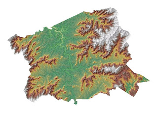
The Terrain Analysis exercise in Module 10 demonstrated the various surface analysis functions - all of which displayed their data in a very visual and easy to interpret format.
ArcMap allows you to create maps very effectively and efficiently.
The Terrain Analysis exercise in Module 10 demonstrated the various surface analysis functions - all of which displayed their data in a very visual and easy to interpret format.
Tuesday, April 15, 2008
Thursday, April 3, 2008
Class 04-03-08
Tonight's class was very interesting. I think the ability to insert buffers, and unions are an essential part of much environmental impact research, which is a field I am very interested in.
The capability of a GPS unit to track such detailed coordinates with such little effort is amazing - it was really cool to see where we had skiied and hopefully we can invest in a GPS so we cna track all of our adventures.
The capability of a GPS unit to track such detailed coordinates with such little effort is amazing - it was really cool to see where we had skiied and hopefully we can invest in a GPS so we cna track all of our adventures.
Subscribe to:
Comments (Atom)


